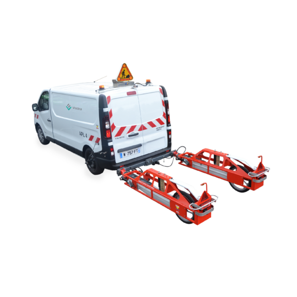
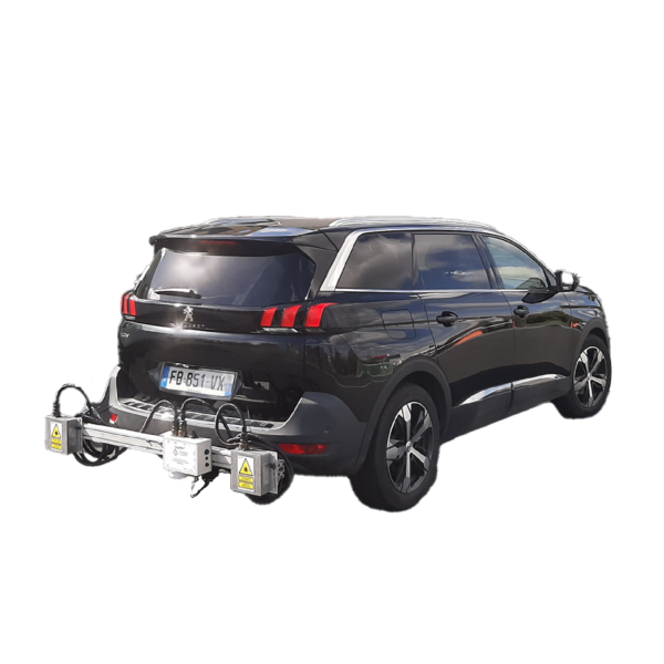
UNIBOX-V


logo-vectra logo-mlpc EN 13036-6

 
Longitudinal evenness measurement without contact
 
The UNIBOX-V is a simple, compact and inexpensive system capable of characterizing the longitudinal profile of a road infrastructure.


Request information

Description

The UNIBOX V is a simple, compact and inexpensive system capable of describing the longitudinal profile of a piece of road infrastructure. Easily integrated into a vehicle, the system measures the longitudinal profile of the wearing course for wavelength variations between 50 cm and 50 m (optimal operating interval compatible with the measure of evenness).

It is a device essentially intended for the quality control of construction sites. It is delivered with a data acquisition software and simplified operating software that automatically returns the longitudinal profile and associated indicators at the end of the measurement.

UNIBOX V:

  • Is equipped with low cost sensors (accelerometer and laser sensor)
  • Uses GPS for distance and geolocation

Features

DATA ACQUISITION AND PROCESSING SOFTWARE
UNIVIEW
The UNIVIEW software is the UNIBOX measurements viewer. It allows reading and displaying the contents of the various files in the form of tables, itinerary diagrams or cartography, as well as environment images synchronized with the measurements
APL 2015 SOFTWARE UNIBOX-V DATA
APL 2015 UNIBOX-V Data is the new version of the version of the APL 2000 software. NextRoad as a publisher and publisher and distributor, offers this solution for advanced processing of UNIBOX-V data. APL 2015 UNIBOX-V data does not allow to edit reports for the reception of wearing courses before or after works.
UNISOFT
The UNIBOX data management is provided by the UNISOFT software that allows to synchronize the UNIBOX data with distance information (incremental encoders and/or GPS). At the end of the measurement, a process is automatically executed to deliver the profile along the road (sampled in 5 cm steps) as well as the various usual indicators (NBO, DSP, IRI), all in accordance with the standard MEC (roadway testing means) format. A test report is automatically generated (PDF format) showing all the results as itinerary diagrams

Datasheet